Gazetteer
A geographical index or dictionary used with maps.

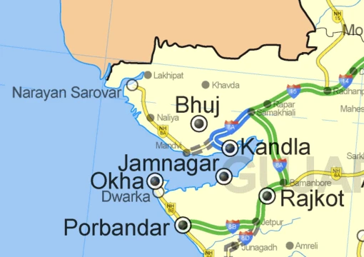
A gazetteer is a geographical dictionary or directory used in conjunction with a map or atlas. It typically contains information concerning geographical makeup, social statistics, and physical features of a country, region, or continent. Content can include a subject's location, dimensions of peaks and waterways, population, gross domestic product, and literacy rate, generally divided into topics with entries listed in alphabetical order. Gazetteers have existed since ancient times, with known examples from the Hellenistic era and first-century China, and they remain a standard reference tool in libraries and on the internet.
- field
- Geography, reference works
- known_for
- Geographical dictionary or directory used with maps
- first_known_Chinese_gazetteer
- First century
- earliest_known_Western_example
- Hellenistic era
- modern_availability
- Reference sections of most libraries and on the internet
Lore & Background
The Oxford English Dictionary defines a gazetteer as a 'geographical index or dictionary'. Echard wrote that the title was suggested by a 'very eminent person' whose name he chose not to disclose. Historian Robert C. White suggests this person was Edmund Bohun, but Echard may have omitted his name because Bohun became associated with the Jacobite movement. Since the 18th century, 'gazetteer' has also been used interchangeably to mean a daily newspaper, such as the London Gazetteer. Gazetteers are often categorized by type and scope. World gazetteers list countries alphabetically with statistics; short-form gazetteers, used with computer mapping and GIS, contain place-names and coordinates; descriptive gazetteers include lengthy textual descriptions; and thematic gazetteers list places by theme, such as fishing ports or nuclear power stations. Editors gather facts from official government reports, censuses, chambers of commerce, and other sources, organizing them in digest form.
Reader's Guide
Gazetteers have served as essential reference tools for centuries, bridging geography, history, and administration. Ancient Greek gazetteers existed since the Hellenistic era, and the first known Chinese gazetteer was released by the first century. With the age of print media in China by the ninth century, the Chinese gentry produced gazetteers for local areas as sources of information and local pride. The geographer Stephanus of Byzantium wrote a geographical dictionary in the sixth century that influenced later European compilers, though parts of it are now missing. These works established the format of alphabetical listings with geographical coordinates and descriptive data. Modern gazetteers continue this tradition, now available in digital form and integrated with GIS systems, making them indispensable for navigation, planning, and research.
Did You Know?
- The first known Chinese gazetteer was released by the first century, and by the ninth century the Chinese gentry produced them for local areas.
- Stephanus of Byzantium wrote a sixth-century geographical dictionary that influenced later European compilers, though parts are missing.
Frequently Asked Questions
What is a Gazetteer in the world of maps and cartography?
A gazetteer is a geographical dictionary that pairs with a map or atlas to supply detailed textual data about places. Think of it as the factual 'data sheet' that sits behind the visual picture a map provides.
What kind of information does a Gazetteer typically list?
Entries cover a location's coordinates, the dimensions of peaks and waterways, population counts, economic indicators like GDP, and social metrics such as literacy rates. The material is usually split into thematic sections with entries running alphabetically.
How old is the Gazetteer tradition?
The format has been around for well over two millennia, with documented examples from the Hellenistic era in the West and from first-century China. It is one of the oldest continuous reference formats in geography.
Where can I find a Gazetteer today?
Most public and university libraries stock them in their reference sections, and a large number are also accessible online. They still serve as a standard companion tool for anyone reading or producing maps.
Why is a Gazetteer important to someone studying maps?
A map shows you where features are, but a gazetteer tells you what those features actually measure and how the population there lives and works. Together they form a complete geographical reference that neither could provide on its own.
More in Maps & Their Symbols 1-24
Elsewhere in the Maps & Their Symbols universe
Spotted an error? Know more?
This is a living reference — every entry is fact-audited, and reader corrections feed straight into our audit queue. Suggest an edit · See this site's audit record