Map symbol
Graphical devices representing real-world features on maps.

CdnMCG · CC BY-SA 4.0
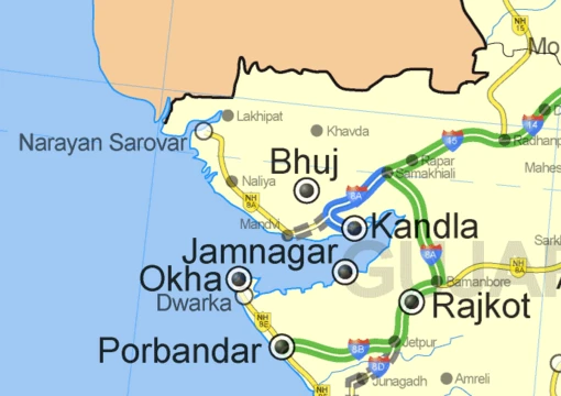
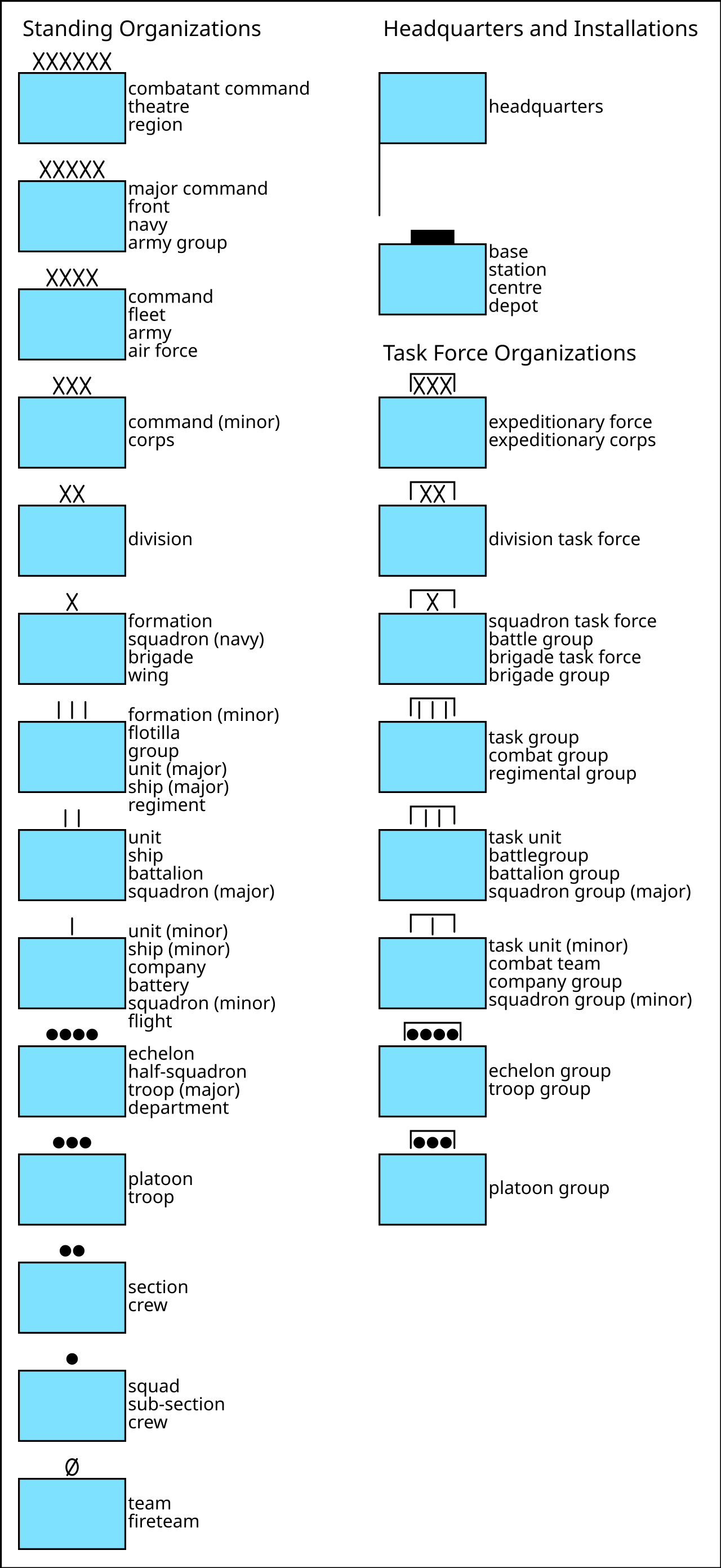
A map symbol or cartographic symbol is a graphical device used to visually represent a real-world feature on a map, working in the same fashion as other forms of symbols. Map symbols may include point markers, lines, regions, continuous fields, or text; these can be designed visually in their shape, size, color, pattern, and other graphic variables to represent a variety of information about each phenomenon being represented. Map symbols simultaneously serve several purposes: declare the existence of geographic phenomena, show location and extent, visualize attribute information, add to or detract from the aesthetic appeal of the map, and establish an overall gestalt order to make the map more or less useful, including visual hierarchy.
- field
- Cartography
- known_for
- Graphical devices representing real-world features on maps
- purpose
- Declare existence, show location, visualize attributes, add aesthetic appeal, establish visual hierarchy
- visual_variables
- Position, size, shape, value, color, orientation, texture/grain
- symbol_types
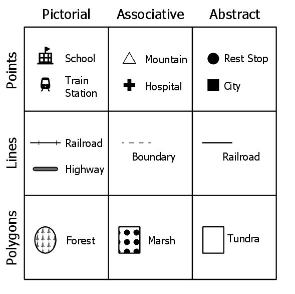
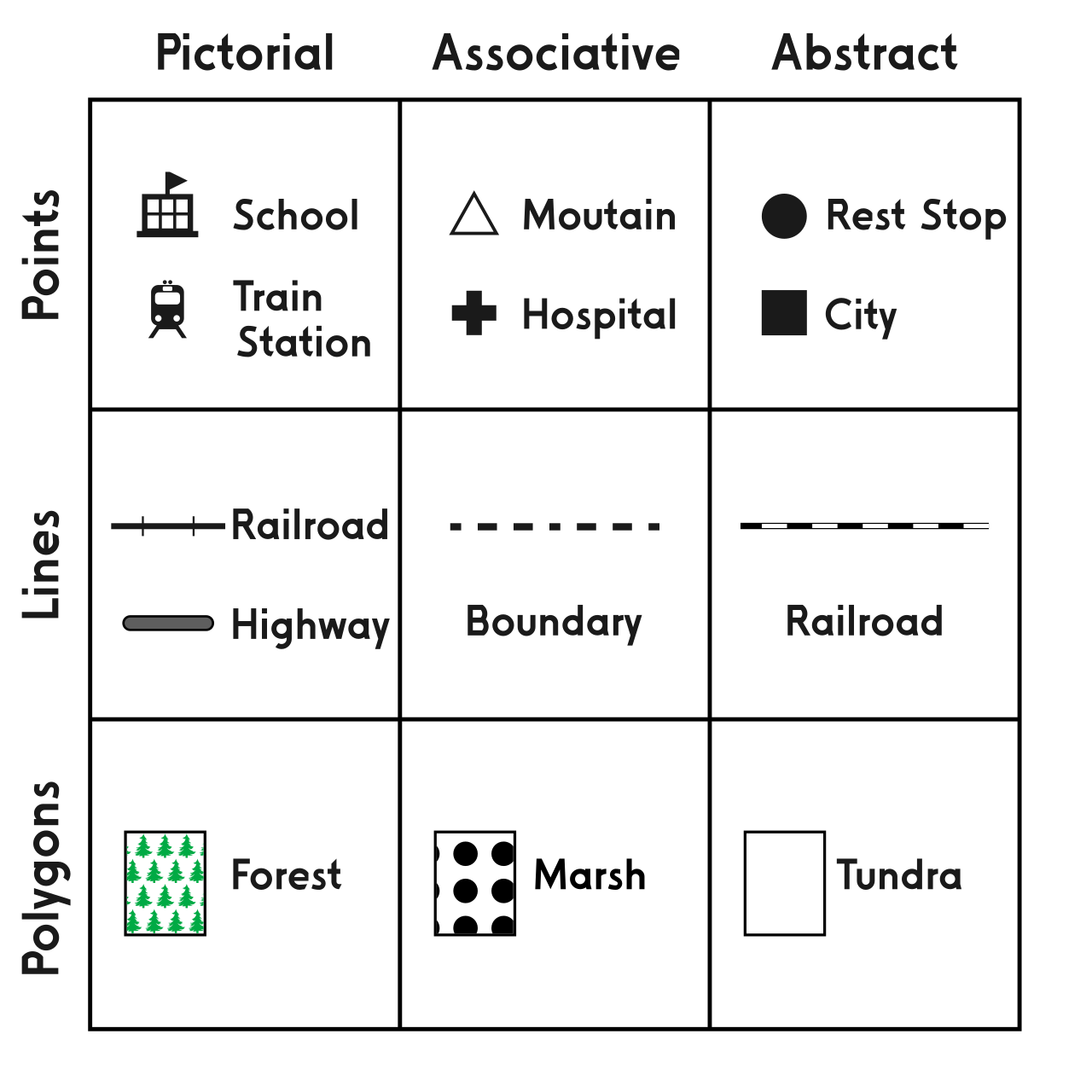
- Iconic, functional, conceptual, conventional, ad hoc
Lore & Background
Map symbols are used to represent geographic phenomena, which exist in and are represented by a variety of spatial forms. Different kinds of symbols are used to portray different spatial forms. Phenomena can be categorized by ontological form—objects such as buildings, cities, roads, lakes, and countries, and masses such as air, water, vegetation, and rock—and by dimensionality, which determines a choice of geometric primitive. The dimensionality of a map symbol may or may not match the real-world feature due to cartographic generalization; for example, a three-dimensional road is often represented as a one-dimensional line symbol, while two-dimensional cities are frequently represented by zero-dimensional points. Many map symbols visualize not just location and shape but also properties or attributes, categorized according to the classification system of Stanley Smith Stevens or a revision thereof. In cartography, principles of cognition explain why certain map symbols work. According to the semiotic theory of Charles Sanders Peirce, map symbols are read when a connection is made between the graphic mark (the sign), a concept (the interpretant), and a real-world feature (the object or referent). Symbols can be categorized by how they suggest this connection: iconic (similar appearance), functional (directly represent activity), conceptual (represent a concept), conventional (commonly used), or ad hoc (arbitrary, requiring a legend). Jacques Bertin developed the concept of visual variables in his 1967 book 'Sémiologie Graphique,' identifying seven main categories: position, size, shape, value, color, orientation, and texture/grain. Each variable may convey information, provide contrast, establish figure-ground contrast and visual hierarchy, or add aesthetic appeal. Size is effective for quantitative data; shape differentiates nominal categories; color hue differentiates nominal variables or carries psychological connotations; color value connotes ordinal measures; saturation is marginal for property information but effective for figure-ground; orientation communicates real-world orientation; and pattern or texture aggregates similar symbols into a composite.
Reader's Guide
Map symbols are fundamental to cartography, serving as the primary means of translating geographic phenomena into visual representations. Their significance lies in their ability to simultaneously declare existence, show location and extent, visualize attribute information, contribute to aesthetic appeal, and establish visual hierarchy. The categorization of symbols by ontological form and dimensionality allows cartographers to match symbol type to the nature of the phenomenon, while the level of measurement of properties guides appropriate visual variable selection. The semiotic framework of Charles Sanders Peirce provides a theoretical basis for understanding how map readers interpret symbols, distinguishing between iconic, functional, conceptual, conventional, and ad hoc symbols. Jacques Bertin's visual variables—position, size, shape, value, color, orientation, and texture/grain—remain a core framework for symbol design, with each variable having specific strengths for conveying different types of information. The legacy of map symbols extends beyond traditional paper maps into digital geographic information systems, where the same principles apply to interactive and dynamic mapping. Understanding cognition and semiotics helps modern cartographers develop more effective symbols, moving beyond the behaviorist view that treated the human brain as a black box. The ongoing refinement of visual variables and symbol categories continues to shape how geographic information is communicated to diverse audiences.
Did You Know?
- Map symbols can be categorized by how they suggest a connection between the graphic mark, a concept, and a real-world feature: iconic, functional, conceptual, conventional, or ad hoc.
- The dimensionality of a map symbol may differ from the real-world feature due to cartographic generalization; for example, a three-dimensional road is often represented as a one-dimensional line symbol.
- Jacques Bertin identified seven main categories of visual variables in his 1967 book 'Sémiologie Graphique': position, size, shape, value, color, orientation, and texture/grain.
- Color saturation has been found to be of marginal value in representing property information but is very effective at establishing figure-ground and visual hierarchy.
Gallery

Frequently Asked Questions
What is a Map symbol in cartography?
A Map symbol is a graphical device—ranging from simple point markers to shaded regions or text labels—that stands in for a real-world geographic feature so readers can interpret a map at a glance. It functions much like any other symbol system, translating physical or abstract phenomena into visual form.
What visual variables can a Map symbol manipulate?
Designers can encode information through position, size, shape, value (lightness/darkness), color, orientation, and texture or grain. By combining these graphic variables, a single symbol can convey multiple layers of attribute data without cluttering the map.
What are the recognized types of Map symbols?
Cartographers generally classify symbols as iconic (resembling the object), functional (serving a practical reading purpose), conceptual (representing an abstract idea), conventional (widely agreed-upon by tradition), or ad hoc (created for a one-off project). Choosing the right type depends on the audience and the phenomenon being mapped.
What roles does a Map symbol fulfill simultaneously?
A well-designed symbol declares that a geographic phenomenon exists, pinpoints its location and spatial extent, visualizes its attribute values, adds aesthetic appeal, and helps establish a visual hierarchy so readers know what to look at first. All of these purposes work in concert within a single map layout.
Why is the Map symbol considered foundational to the field of Cartography?
Without symbols, a map would be nothing more than blank space; symbols are the bridge between raw geographic data and human comprehension. They are the primary mechanism through which cartographers communicate existence, location, and meaning, making them the core building block of every map ever produced.
More in Maps & Their Symbols 1-24
Elsewhere in the Maps & Their Symbols universe
Spotted an error? Know more?
This is a living reference — every entry is fact-audited, and reader corrections feed straight into our audit queue. Suggest an edit · See this site's audit record